Lake Kaindy, Kazakhstan
The Underwater Forest of Drowned Spruce
Last reviewed on 29 September 2026

Lake Kaindy holds the most surreal sight in Kazakhstan: an underwater forest of spruce trees, drowned but not rotted, whose bleached trunks still rise like ship masts from turquoise water. Created by a landslide after the 1911 Kebin earthquake, the 400-metre-long lake has kept a ghost forest beneath its surface for more than a century, and it is one of the most photographed natural sights in the country.
The name comes from the Kazakh Қайыңды (Qaiyndy), “the place with birches” — usually translated as “birch grove” — after the birches that grow on the approach. The drowned trees themselves are Schrenk’s spruce (Picea schrenkiana). The landslide dammed the gorge and the valley filled with water, and because the lake stays close to freezing all year the submerged parts of the trees have survived with their branches intact.
Lake Kaindy quick facts
- Where: Kolsai Lakes National Park, Almaty Region, south-east Kazakhstan, in the Kungey Alatau range of the Tien Shan — see the map
- Coordinates: 42.9875°N, 78.4639°E
- Nearest village: Saty, about 11km by track
- From Almaty: about 290km by road, 5–6 hours each way; around 130km in a straight line
- Elevation: about 2,000m
- Size: about 400m long, up to 30m deep
- Water temperature: rarely above 6°C, even in summer
- Formed: 1911, by a landslide after the Kebin earthquake
- Other spellings: Kaindy, Kayindy, Qaiyndy, Каинды (Russian), Қайыңды (Kazakh)
- Best time: late May to early July for colour, September for fewer people
- Fees: national park entry fee per person, plus a vehicle charge — see Practical Information
The Lake Experience
What You’ll See
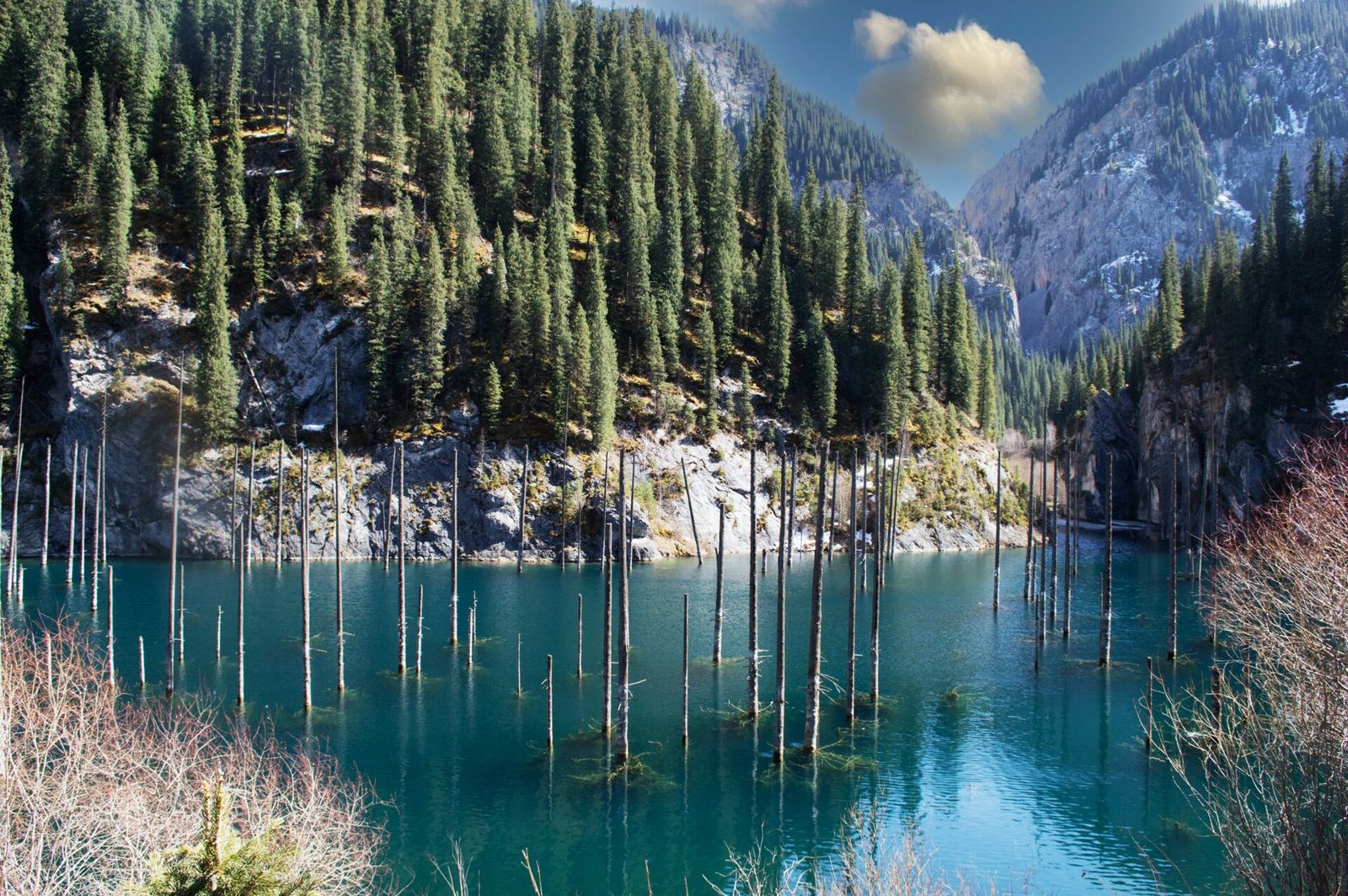
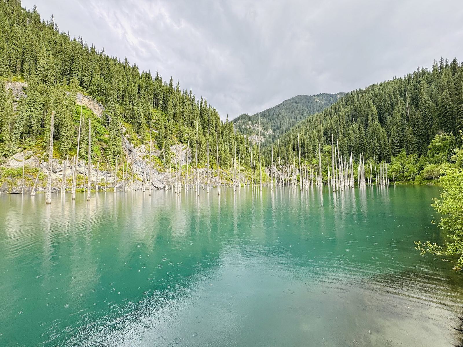
The first glimpse of Kaindy is unforgettable: stark white trunks standing in milky-turquoise water against slopes of dark spruce. Above the waterline the trunks are stripped of bark and bleached by sun and frost, standing several metres clear of the surface. Below it, the trees are much better preserved, with branches still attached and coated in algae and water plants, and in clear conditions you can see them fading down into the blue.
What Colour Is Lake Kaindy, and Why?
On a sunny summer day the water is a bright blue-green, usually described as turquoise. The colour comes from limestone: the landslide that formed the lake was limestone rock, and dissolved minerals and very fine particles in the clear water scatter light at the blue-green end of the spectrum. The shade shifts with the conditions:
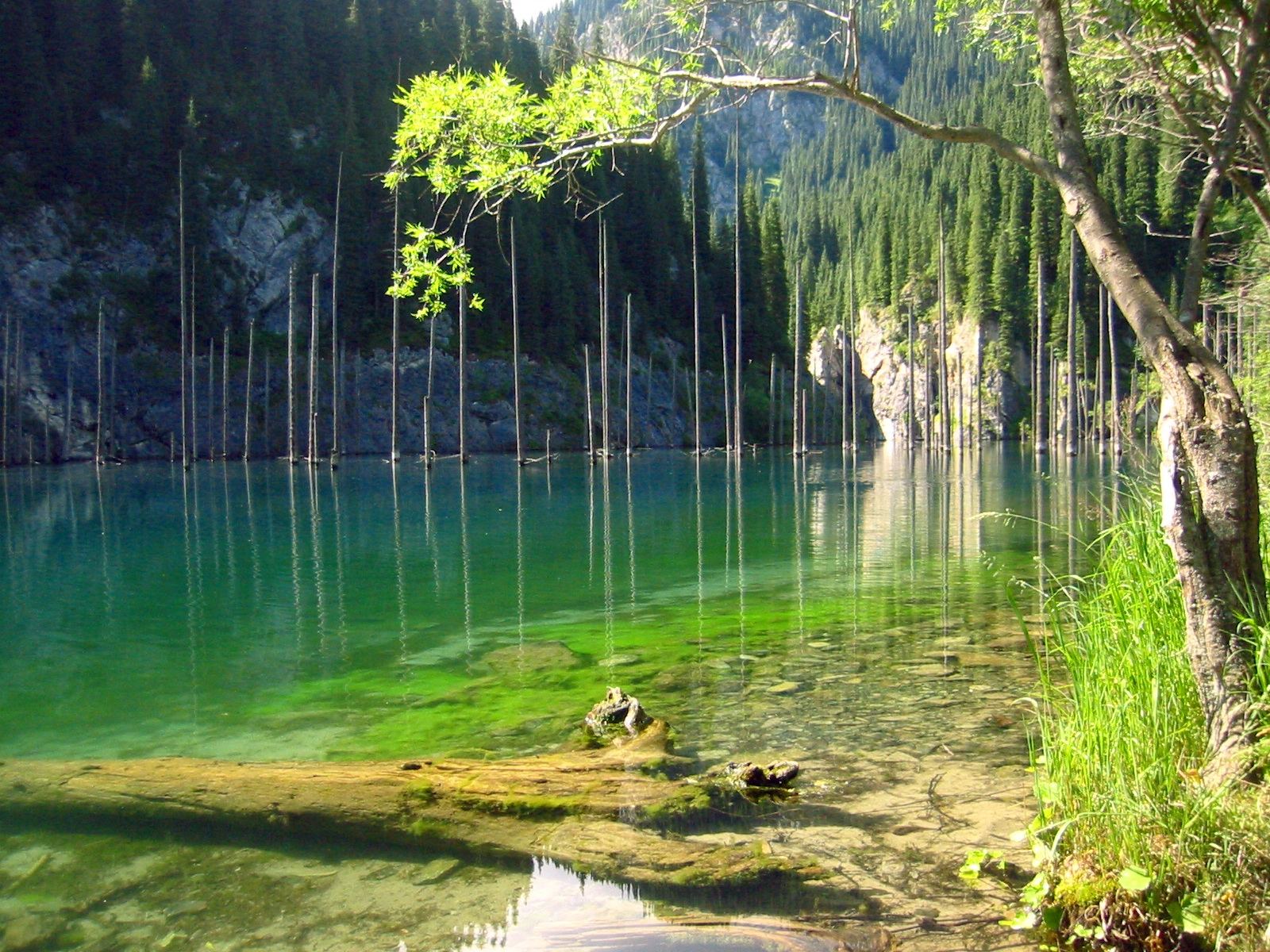
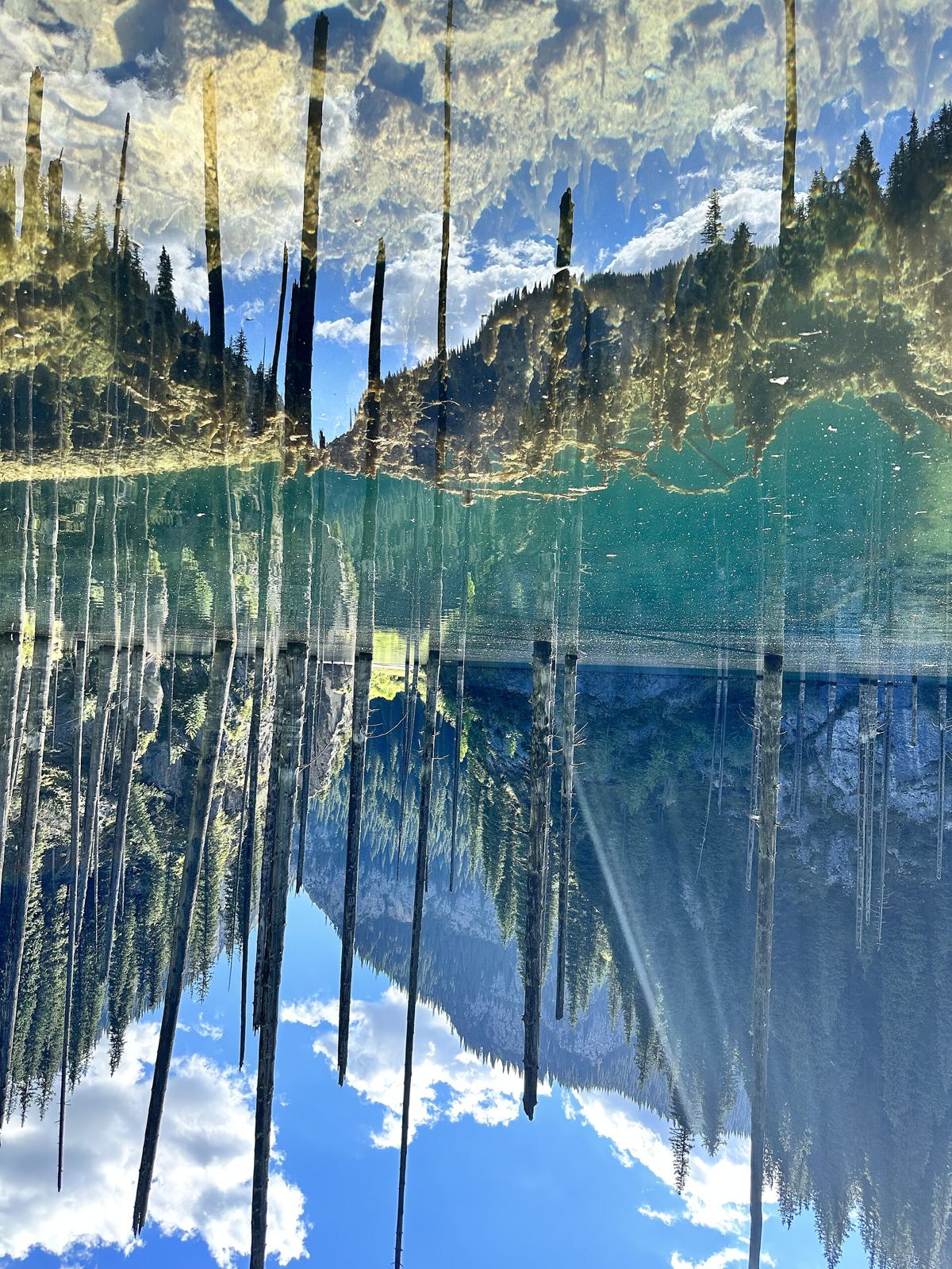
- Sunny, calm mornings: the most intense turquoise, with mirror reflections of the trunks
- Overcast days: flatter, greyer blue-green
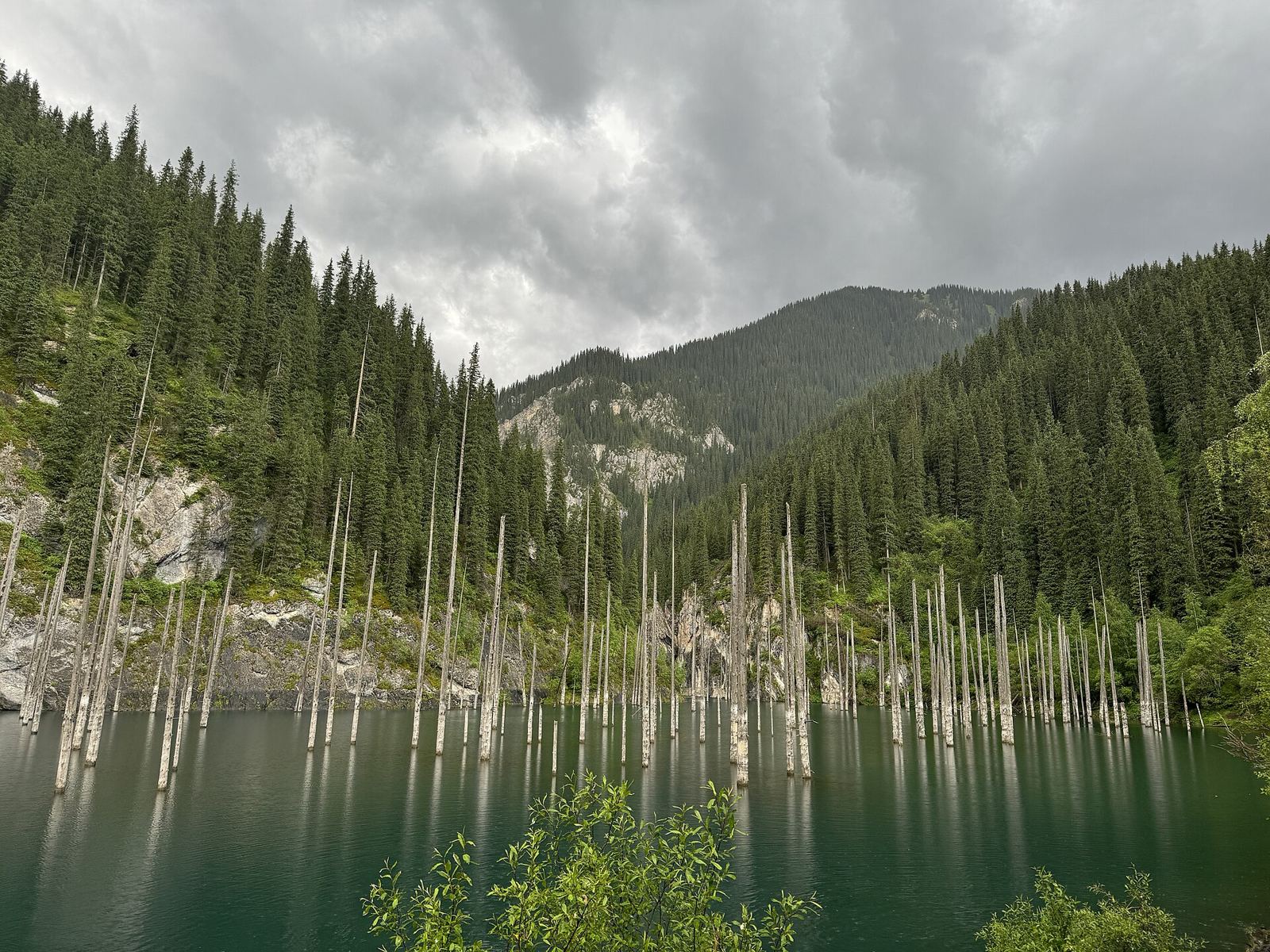
- After heavy rain: runoff clouds the water and it turns a milkier emerald green
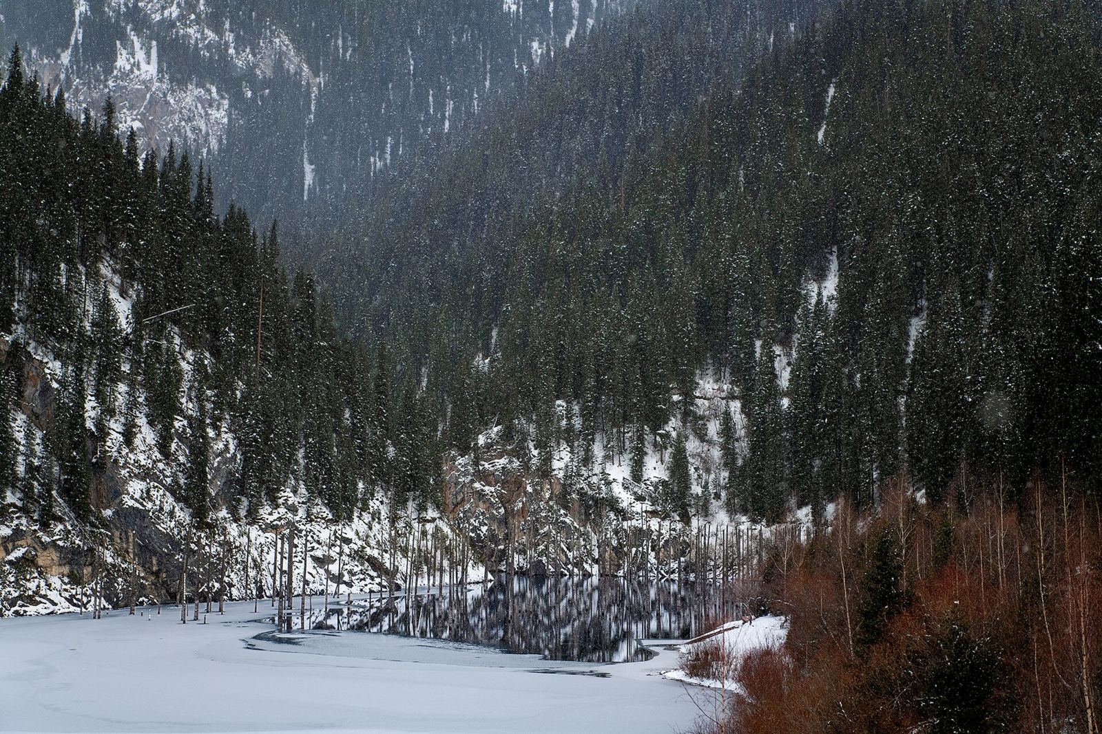
- Winter: white — the surface freezes and the trunks stand in ice and snow
Seasonal Changes
- Spring (May–June): snowmelt brings the highest water levels and the most intense colour; the track can be muddy
- Summer (July–August): warmest weather and easiest access, but the busiest months
- Autumn (September–October): birch and aspen turn gold on the approach, clear air, fewer visitors
- Winter (roughly December–March): the lake freezes with the trunks locked in the ice; access needs a proper 4WD or a winter tour
Lake Kaindy Photos
These photos show the lake in different seasons and from different angles, so you know what to expect before making the long drive. The most familiar view is from the northern end near the path down from the car park, looking along the lake at the trunks.
How to Get to Lake Kaindy
Reaching Kaindy takes effort — the last stretch is a rough mountain track — but the reward justifies the journey. Plan on 5–6 hours from Almaty to the lake shore.
Route from Almaty (about 290km in total)
- Almaty to Saty village: about 280km, 4–5 hours, paved road via Chilik and Baiseit
- Saty to the lake car park: about 11km, 30–45 minutes on a rough track up the Kaindy gorge
- Car park to the lake: roughly 700m on a forest path, about 15 minutes down (a little longer back up)
Road Conditions
The track from Saty to the car park is the hard part:
- Dry conditions: high-clearance vehicle recommended; experienced drivers manage in ordinary cars
- Wet conditions: 4WD essential, the track becomes very muddy
- River crossings: several shallow fords, deeper during snowmelt
- Winter: often impassable without a proper 4WD
Transport Options
Self-Drive
- Rent a 4WD in Almaty: roughly 25,000–40,000₸/day
- Or drive an ordinary car to Saty and take local transport for the last stretch
- Download offline maps before leaving Saty — there is little or no signal beyond the village
From Saty Village
- Local 4WD taxi: roughly 6,000–8,000₸ return with waiting time
- Shared UAZ (Soviet 4WD van): cheaper per person when full; ask at your guesthouse
- Horseback: around 5,000₸ including a guide, about 2 hours each way
- On foot: 11km up the track, 2.5–3 hours one way — beautiful but long
Tours from Almaty
- One-day tour: roughly 10,000–15,000₸/person, with a very early start and 10–12 hours on the road
- Two days with Kolsai: roughly 25,000–35,000₸/person
- Private tour: roughly 40,000–60,000₸ per vehicle
For the wider picture, see our guide to getting around Kazakhstan and Almaty, the starting point for every route here.
Activities
Walking Around the Lake
A rough path follows the shore, with several viewpoints. The eastern shore gives the classic angle with the trunks reflected in calm water. The western shore involves scrambling over rocks but is quieter. Early morning gives mirror-like reflections before the wind picks up.
Diving & Snorkelling
Kaindy offers unusual cold-water diving through a submerged forest:
- Water temperature: 2–6°C all year (drysuit strongly recommended)
- Visibility: several metres on calm days, less after rain
- Depth: up to 30m; the most interesting trunks are in the upper 5–15m
- Equipment: bring it from Almaty (no rental at the lake)
- Winter: ice diving is organised by specialist dive clubs
Warning: extremely cold water; only for experienced cold-water divers.
Photography
- Best light: early morning (roughly 7–9am) for reflections and before tour groups arrive
- Colour: sunny days give the strongest turquoise; a polarising filter helps cut surface glare
- Underwater: waterproof camera or housing needed
- Drone: rules inside the national park change; ask at the checkpoint before flying
- Winter: frozen lake with trunks locked in the ice
Camping
- Camping is possible near the lake, but it is inside a national park — ask at the checkpoint where it is currently allowed
- No facilities: bring everything, including a stove
- Treat stream water before drinking
- Bears live in the area; store food properly
- Nights are cold even in summer
Combining with Other Sites
Kolsai Lakes
Kaindy and the Kolsai Lakes share Saty as their base. The lower Kolsai lake is about 11km west of Kaindy as the crow flies, but by road you go back via Saty — allow about an hour between the two car parks.
- Day 1: drive from Almaty to Saty, visit Kaindy in the afternoon
- Day 2: hike from the lower to the middle Kolsai lake, then drive back to Almaty, or stay a second night
- Trekking: multi-day routes link the valleys; go with a local guide
Charyn Canyon (about 100km)
Charyn Canyon is roughly on the way, so a three-day loop covers the region’s highlights:
- Day 1: Almaty to Charyn Canyon, then on to Saty
- Day 2: Kaindy and Kolsai Lakes
- Day 3: return to Almaty
See our Kazakhstan itineraries and trips from Almaty for how the routes fit together.
Practical Information
Entry Fee and Park Rules
Lake Kaindy is inside Kolsai Lakes National Park (established 2007), a protected area. Rangers at the checkpoint on the track collect a national park entry fee per person plus a charge per vehicle. The fee is modest, usually a few hundred to around a thousand tenge per person, but rates change and can differ for foreign visitors, so carry cash and check the current price at the checkpoint. Fires, fishing and drones are restricted; pack out all rubbish.
When to Visit
- Best overall: June–September (warm, accessible, long days)
- Colour and photography: late May–early July (highest water, most intense colour)
- Fewer crowds: weekdays and September
- Avoid: April (muddy) and November (cold, but the lake is not yet reliably frozen)
What to Bring
- Waterproof hiking boots (the path can be muddy)
- Warm layers (it is cold at 2,000m)
- Rain gear (afternoon storms are common)
- Lunch and snacks (no facilities at the lake)
- Water, or a way to treat stream water
- Sunscreen and a hat
- Dust protection for your camera
- Cash for transport and park fees (no ATMs past the main road)
Accommodation
There is nowhere to stay at the lake itself. Saty village, about 11km away, has plenty of simple options (see our accommodation guide):
- Guesthouses: roughly 5,000–8,000₸/person with meals
- Homestays: roughly 4,000–6,000₸/person
- Camping: ask permission from your hosts
Important Tips
- Timing: arrive before 10am to beat the tour groups
- Safety: the water is extremely cold; don’t swim without preparation
- Weather: changes fast; always carry warm clothes (see our weather guide)
- Altitude: about 2,000m — noticeable for some, but rarely a problem
- Wildlife: bears and wolves live here but are rarely seen
- Leave no trace: pack out all rubbish
- Road updates: ask your Saty guesthouse about current track conditions
- Fuel: fill up on the main road before Saty; there is no station at the lake
- Mobile signal: expect little or none beyond Saty village
History: How the Underwater Forest Formed
The Kebin earthquake of January 1911, one of the strongest recorded in Central Asia (magnitude around 7.7–8), set off landslides across the northern Tien Shan. At Kaindy, limestone debris blocked the gorge and formed a natural dam. The valley behind it flooded, drowning a mature spruce forest. Those trees have now stood in water for more than a century.
Local stories tell of a lost village beneath the water, but there is no evidence for it — the valley held forest, not houses. The lake was little known outside Kazakhstan until after independence, and it is now a fixture of nature documentaries and photo books. For the bigger picture, see our overview of Kazakhstan’s history.
Lake Kaindy: Questions Travellers Ask
Where is Lake Kaindy located?
Lake Kaindy is in Kolsai Lakes National Park in the Almaty Region of south-east Kazakhstan, in the Kungey Alatau range of the Tien Shan, at 42.9875°N, 78.4639°E. It is about 11km by track from Saty village and around 290km by road east of Almaty, a drive of 5–6 hours. The map on this page shows the exact spot.
Is Lake Kaindy in Akmola Region?
No. Lake Kaindy is in the Almaty Region in the far south-east, near the Kyrgyz border. Akmola Region is in the north of the country; its well-known lakes are around Borovoe (Burabay), more than 1,000km away and about three hours by road from Astana. The two are sometimes confused online, but they are completely different places.
Why are the trees in Lake Kaindy still standing after a century?
The water is the reason. Lake Kaindy is fed by snowmelt and rarely rises above about 6°C, and the bacteria and fungi that rot wood barely work at that temperature. So the submerged parts of the Schrenk’s spruce trees have kept their branches since the lake formed in 1911, while the sections above the waterline have lost their bark and bleached white.
What colour is Lake Kaindy, and why?
On a sunny day it is a bright blue-green, usually called turquoise. The colour comes from dissolved limestone and very fine mineral particles from the landslide that formed the lake, which scatter blue-green light. It looks greyer under cloud, turns a milkier emerald green after heavy rain, and is white with ice and snow in winter.
Are there fish or wildlife at Lake Kaindy?
There are trout in the lake, and local anglers fish for them through the ice in winter, but fishing is restricted inside the national park, so check the rules at the checkpoint. The surrounding forest is home to roe deer, foxes, marmots and, higher up, ibex; brown bears and wolves live in the range but are very rarely seen by day visitors. Store food properly if you camp.
Does Lake Kaindy freeze in winter?
Yes. From roughly December to March the surface freezes and the trunks stand in snow-covered ice, which is spectacular to photograph and draws specialist ice-diving trips. The track from Saty is often impassable in winter without a proper 4WD, so most winter visitors go with a tour. Only walk on the ice if locals confirm it is thick enough.
Is there an entry fee for Lake Kaindy?
Yes. The lake is inside Kolsai Lakes National Park, a protected area, and rangers at the checkpoint on the track charge an entry fee per person plus a vehicle charge. The fee is modest, but rates change and can differ for foreign visitors, so carry cash and check the current price on the day.
Can you swim or dive in Lake Kaindy?
Diving is possible, but at 2–6°C all year it is cold-water diving that needs a drysuit, experience and your own equipment from Almaty. Casual swimming is a bad idea: the cold shock is real, there is no rescue cover, and the submerged branches are a snag hazard. Most visitors walk the shore instead.
How long do you need at Lake Kaindy?
Two hours is enough to walk down from the car park, follow the shore and photograph the classic view. Because the drive from Almaty takes 5–6 hours each way, most people stay a night in Saty and pair the lake with the Kolsai Lakes the next day, or make a three-day loop that also takes in Charyn Canyon.
What is the best time to visit Lake Kaindy?
Late May to early July, when snowmelt pushes the water to its highest and the colour is most intense. September gives clear air, golden birches and far fewer visitors. Winter is beautiful but access is difficult.
How do you spell Kaindy?
You will see Kaindy, Kayindy and Qaiyndy in English, “Каинды” in Russian and “Қайыңды” in Kazakh. The name means roughly “the place with birches”, often translated as “birch grove”. All refer to the same lake.
Is this the “haunted forest” of Kazakhstan?
It is usually the place people mean. The white trunks standing in still water look like a drowned graveyard, and the lake is sometimes described online as haunted or as covering a sunken village. There is no village under the lake and nothing supernatural: just a 1911 earthquake, a landslide dam and a flooded forest.
Where Is Lake Kaindy? Map and Coordinates
Lake Kaindy lies in Kolsai Lakes National Park in the Almaty Region of south-east Kazakhstan, in the Kungey Alatau range of the Tien Shan, at 42.9875°N, 78.4639°E. The nearest settlement is Saty village, about 11km away by track; Almaty is around 290km away by road. The lower Kolsai lake is about 11km to the west. There is little or no mobile signal past Saty, so download an offline map before you leave the village. Open Lake Kaindy on OpenStreetMap.