Kolsai Lakes (Kolsay), Kazakhstan
The Pearls of Northern Tien Shan
Last reviewed on 29 September 2026

The Kolsai Lakes — spelled Kolsai or Kolsay on different maps and signs, from the Kazakh Көлсай — are three alpine lakes stacked up a single valley in the Northern Tien Shan, close to the Kyrgyz border. You can drive to the first one, walk to the second in about three hours, and reach the upper lake only with a full day and some altitude tolerance. Which of the three you aim for is the single decision that shapes a trip here.
The lakes sit above Saty village, the same base used for Lake Kaindy and its underwater forest, which is why almost nobody visits just one of them.
Kolsai Lakes at a glance
- Where: Kolsai Lakes National Park, Almaty Region, about 10km south of Saty village — see the map
- From Almaty: about 280km by road to Saty, 4–5 hours
- Lower (first) lake: 1,818m, reached by road
- Middle (second) lake: 2,252m, about 8km and 2.5–3.5 hours on foot from the lower lake
- Upper (third) lake: about 2,850m, a further 6km and 3–4 hours
- Best time: June–September
Created by ancient landslides that dammed the Kolsai River, these lakes sit like steps on a giant's staircase ascending through ecosystems from coniferous forest to alpine meadows. The pristine waters shift from deep blue to emerald green depending on season and sunlight, perfectly reflecting the surrounding peaks and forests. The lakes have been protected as Kolsai Lakes National Park (Kolsay Kolderi) since 2007; the park covers about 1,600 square kilometres and also includes Lake Kaindy.
The Three Lakes: Which One to Hike To
The three Kolsai lakes lie in a line up the same valley, each higher, colder and emptier than the last. Times below are one way, from the first lake, at an unhurried pace.
- First (Lower) Kolsai Lake, 1,818m — reached by road. Boats, guesthouses, cafes. Busy at weekends. No hike required.
- Second (Middle) Kolsai Lake, 2,252m — about 8km and 2.5–3.5 hours up a forest trail (about 430m of net climbing), or around 2 hours on a hired horse. The classic day out and the most photographed of the three.
- Third (Upper) Kolsai Lake, 2,850m — a further 6km and 3–4 hours above the second lake, close to the Kyrgyz border. A long day from the first lake, or an overnight at the second. Snow can linger here into June.
Border note: the upper lake is inside the border zone with Kyrgyzstan. Carry your passport and be prepared to show it. The Sary-Bulak pass beyond it is not an official border crossing, so do not continue into Kyrgyzstan.
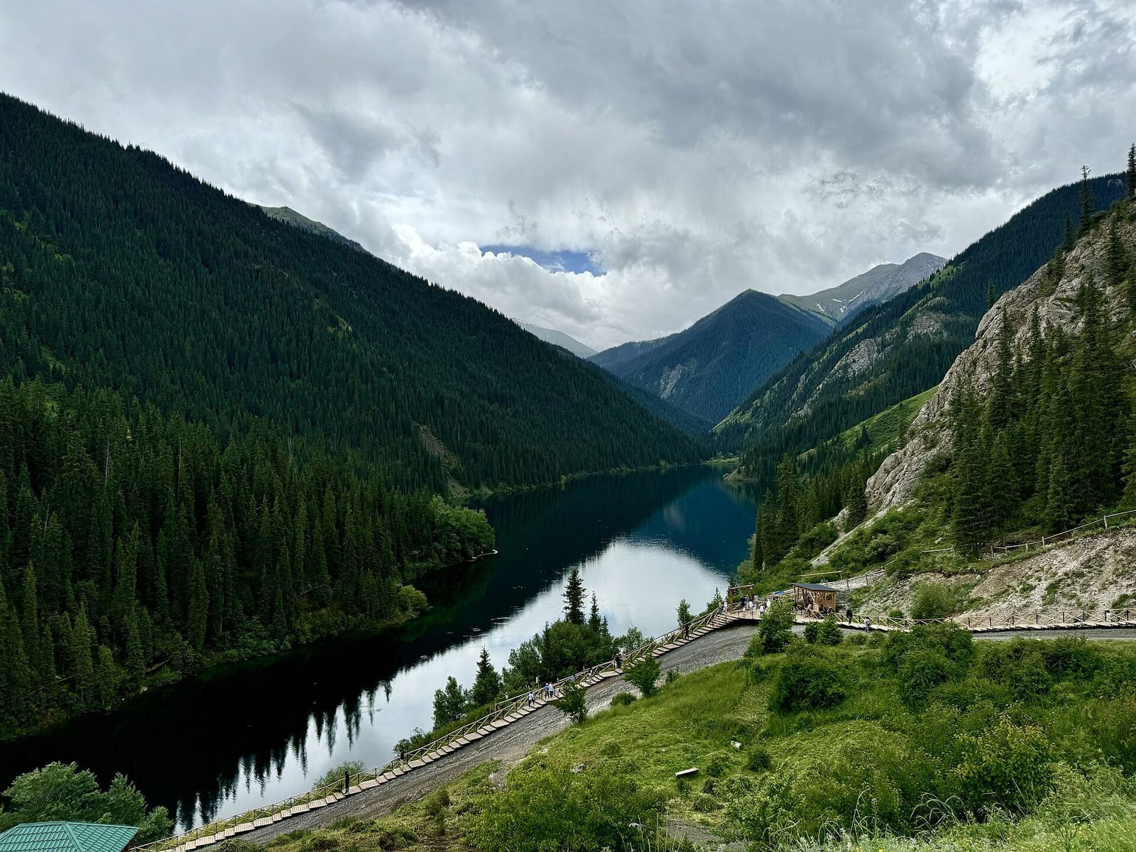
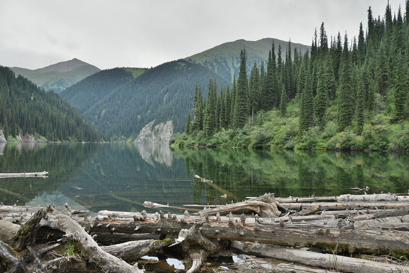
Lower Kolsai Lake (First Lake)
Elevation: 1,818m | Length: 1km | Depth: up to 80m
The most accessible of the three, surrounded by spruce forest and meadows. A well-maintained trail circles the lake (1-hour walk), offering multiple viewpoints and picnic spots. The eastern shore features the main facilities: parking, guesthouses, boat rental, and camping areas. This lake sees the most visitors but remains peaceful outside weekends.
Activities: Boat rental (2,000₸/hour), fishing (permit required), horseback riding (3,000₸/hour), easy hiking trails
Facilities: Toilets, changing cabins, cafes (summer), equipment rental
Middle Kolsai Lake (Mynzhylgy/Second Lake)
Elevation: 2,252m | Distance from First Lake: about 8km on the trail | Hiking time: 2.5–3.5 hours one way
The most photogenic lake, reached via a moderate forest trail with about 430m of net elevation gain. The turquoise waters are framed by vertical cliffs and dense spruce forests. Less crowded than the first lake, it offers superior scenery and tranquility. The trail provides stunning viewpoints, especially at the halfway point where both lakes are visible.
Trail conditions: Well-marked path, some steep sections, stream crossings on logs
Camping: Designated areas with fire pits, no facilities
Best time: Early morning for mirror-like reflections
Upper Kolsai Lake (Third Lake)
Elevation: about 2,850m | Distance from Second Lake: about 6km | Hiking time: 3–4 hours one way
The smallest and highest lake requires a challenging hike through alpine meadows and scree. The trail becomes less distinct, requiring route-finding skills. At this elevation, you're above the tree line with panoramic views of the Kungey Alatau ridge. The lake often remains partially frozen until July.
Important: From here, a 6km trail leads to Sary-Bulak Pass (3,278m) and into Kyrgyzstan (not an official border crossing — do not cross into Kyrgyzstan)
Preparation: Start early, bring warm clothes, consider altitude effects
Hiking & Trekking
Day Hikes
- Lake Circuit (Easy): 3km loop around First Lake, 1 hour, suitable for families
- To Second Lake (Moderate): 16km return, 5-7 hours, most popular trek
- Panorama Point (Easy-Moderate): 2km from First Lake, great sunrise spot
Multi-Day Treks
- Three Lakes Trek: 2 days, camp at Second Lake
- Longer treks: routes linking the Kolsai valley with neighbouring valleys, including towards Kaindy, are possible with a local guide
- Sary-Bulak pass (3,278m): a day beyond the upper lake; the trail continues towards Issyk-Kul in Kyrgyzstan, but this is not a legal border crossing
Trail Conditions by Season
- June: Snow patches above 2,500m, wildflowers beginning
- July-August: Perfect conditions, all lakes accessible, peak season
- September: Golden autumn colors, cold nights, fewer visitors
- October-May: Snow-covered, First Lake accessible, others require winter gear
Getting There
From Almaty (280km, 4-5 hours)
By Car
- Route: Almaty → Chilik → Baiseit → Saty village → Kolsai Lakes (10km from Saty)
- Road conditions: Paved to Saty, then gravel road to lakes (suitable for regular cars in summer)
- Fuel: Last station in Baiseit (fill up here)
Public Transport
- Bus to Saty: from Sayakhat bus station (limited, often weekends only; roughly 2,500–3,500₸, about 5 hours)
- Marshrutka: to Chilik (Shelek), then a taxi for the rest of the way; schedules change, so check at the bus station
- From Saty: Local taxi to lakes (3,000-5,000₸) or hitchhike
Organized Tours
- Day trip: 8,000-12,000₸/person (transport, guide, lunch)
- 2-day tour: 20,000-30,000₸/person (includes Kaindy Lake, accommodation)
- Private car with driver: 25,000-35,000₸/day
Accommodation
At the Lakes
- Kolsai Lakes Guesthouse: Basic rooms near First Lake (8,000-12,000₸)
- Yurt camps: Traditional accommodation, meals included (6,000-10,000₸/person)
- Camping: Designated areas (1,000₸/tent), bring all equipment
Saty Village (10km from lakes)
- Guesthouses: Family-run, meals included (5,000-8,000₸/person)
- Saty Village Hotel: Best option in village (15,000₸/room)
- Homestays: Authentic experience (4,000-6,000₸ with breakfast)
Booking: Essential in July-August; can usually find space other times
Park Regulations & Fees
Entry Fees (indicative — check at the checkpoint)
- Park entry: 750₸/person
- Vehicle: 1,000₸
- Camping: 1,000₸/tent/night
- Fishing permit: 2,000₸/day (catch limits apply)
Rules
- No swimming in lakes (cold and protected)
- Fires only in designated areas
- Pack out all trash
- No loud music or generators
- Drone flights require permission
- Stay on marked trails
Activities
Summer (June-September)
- Hiking: Main attraction, trails for all levels
- Horseback riding: 3,000-5,000₸/hour, guided trips available
- Mountain biking: Bring your own or rent in Almaty
- Fishing: Trout in all lakes (permit required)
- Photography: Best light early morning and golden hour
- Birdwatching: 200+ species including golden eagles
Winter (December-March)
- Snowshoeing: To frozen First Lake
- Cross-country skiing: Bring equipment
- Ice fishing: Local guides recommended
- Winter camping: For experienced only
Combining with Kaindy Lake
Most visitors combine Kolsai with Lake Kaindy and its sunken forest, about 11km east of the lower lake in the next valley. By road you go back through Saty:
- By car: about an hour from the lower Kolsai car park to the Kaindy car park; the last 11km from Saty is a rough track (4WD recommended)
- From Saty: local 4WD taxis and horses run to Kaindy (see the Kaindy guide for options and prices)
- Best plan: Day 1: Kaindy in the afternoon after driving from Almaty; Day 2: hike to the middle Kolsai lake
What to Bring
Essential
- Sturdy hiking boots (trails can be muddy)
- Warm layers (cold at altitude even in summer)
- Rain jacket (afternoon storms common)
- Sun protection (high altitude sun)
- Water bottles (and a way to treat stream water)
- Snacks and lunch for hiking
- Cash (no ATMs in area)
Recommended
- Trekking poles for steep sections
- Binoculars for wildlife
- Water purification tablets
- First aid kit
- Camping gear if staying overnight
- Fishing rod (if planning to fish)
Practical Tips
- Best time: July-August for weather, June for wildflowers, September for autumn colors
- Avoid: Weekends in summer (crowded), October-May (snow)
- Altitude: Acclimatize in Almaty first, ascend slowly
- Weather: Changes quickly; always prepare for rain and cold
- Mobile signal: Limited to First Lake area only
- Guides: Not required but helpful for multi-day treks
- Water: treat stream water before drinking; don’t drink from the lakes
- Wildlife: Bears present but rarely seen; make noise while hiking
- Photography: Sunrise/sunset best; bring extra batteries (cold drains them)
Nearby Attractions
- Kaindy Lake: sunken forest lake, about 11km from Saty
- Charyn Canyon: about 100km away, often combined in 3-day trips
- Tekes Waterfall: 30km from Saty, requires 4WD
- Karakara Valley: Remote valley with petroglyphs
Kolsai Lakes: Questions Travellers Ask
How far is it from Kolsai lake 1 to lake 2?
About 8km one way on the trail from the lower-lake car park to the middle lake (roughly 5km up the valley in a straight line). The trail climbs from 1,818m to 2,252m, a net gain of about 430m, with some extra up and down along the way. Allow 2.5–3.5 hours up and 2–2.5 hours back, or about 2 hours each way on a hired horse.
How long is the hike from lake 2 to the upper Kolsai lake?
The upper (third) lake is about 6km beyond the middle lake and around 600m higher, at roughly 2,850m. Allow 3–4 hours one way on a fainter trail through alpine meadow and scree. From the lower lake that makes a very long day, so most people camp at the middle lake.
Is it Kolsai or Kolsay?
Both are correct transliterations of the Kazakh Көлсай. Kolsai is the most common spelling in English, Kolsay appears on many maps and in the official park name, and you will also see “Kolsay Kolderi”, which simply means “Kolsay lakes”.
Are the Kolsai Lakes a national park?
Yes. The lakes are the centre of Kolsai Lakes National Park (Kolsay Kolderi), created in 2007 and covering about 1,600 square kilometres of the Kungey Alatau. Lake Kaindy is in the same park. Entry fees are collected at the park checkpoint.
Can you drive to the lower Kolsai lake?
Yes. A road runs about 10km from Saty village to the car park at the lower (first) lake, and ordinary cars manage it in summer. The middle and upper lakes can only be reached on foot or on horseback.
How far are the Kolsai Lakes from Almaty?
About 280km by road to Saty village, 4–5 hours, then another 10km to the lower lake. Most visitors stay at least one night in Saty and combine the lakes with Lake Kaindy.
Can you swim in the Kolsai Lakes?
Swimming is not allowed in the lakes, which are protected and very cold. Rowing boats can be hired on the lower lake in summer.
Kolsai Lakes Map and Location
The lower Kolsai lake is at about 42.986°N, 78.325°E, some 10km south of Saty village in the Kungey Alatau. The middle and upper lakes lie further up the same valley to the south, towards the Kyrgyz border; Lake Kaindy is about 11km to the east. Open the Kolsai Lakes on OpenStreetMap.