Mangystau
Chalk Canyons, Stone Spheres and Underground Mosques Beyond Aktau
Last reviewed on 29 September 2026
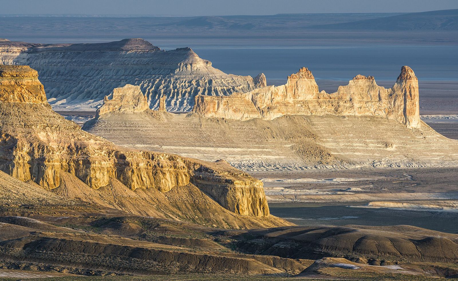
Mangystau (also spelled Mangistau, and historically Mangyshlak) is the desert region that fills Kazakhstan's far west between the Caspian Sea and the Ustyurt Plateau. It is one of the strangest landscapes in Central Asia: white and pink chalk cliffs, fields of stone spheres, a mountain shaped like a yurt, salt flats below sea level and mosques carved into rock by Sufi hermits. Almost all of it is reached from one city, Aktau, and almost none of it by public transport.
This guide covers the main sights, realistic driving distances from Aktau, how 4x4 tours work, which areas need permits, when to go and how to camp safely. If you are still deciding whether the trip is worth the flight west, the short answer is yes for anyone who likes big empty landscapes — but give it at least three days, because the best places are a long way from the city and from each other.
Mangystau at a Glance: Main Sights and Distances from Aktau
Distances are approximate road distances from Aktau; the final stretch to most sites is on unpaved desert tracks, so allow far more time than the kilometres suggest.
- Karagiye Depression — about 50km: the lowest point in Kazakhstan at −132m. Easy half-day.
- Shakpak-Ata underground mosque — about 135km: rock-cut mosque and necropolis on the Tupkaragan peninsula. Day trip, usually with Fort-Shevchenko.
- Torysh, the Valley of Balls — roughly 120–160km: stone spheres scattered across the steppe near Shetpe. Day trip.
- Sherkala — about 170km: the isolated “yurt mountain” near Shetpe, often combined with Torysh and the Airakty valley.
- Beket-Ata underground mosque — roughly 280km: western Kazakhstan's most important pilgrimage site, on the edge of the Ustyurt.
- Boszhira — roughly 300km: the famous chalk towers and canyons of the Ustyurt escarpment. Best as an overnight camping trip.
- Tuzbair salt flat — roughly 250–300km: a white salt pan under the Ustyurt cliffs, usually on the same trip as Boszhira.
The only town of any size is Aktau. Zhanaozen (about 150km south-east) and Shetpe (about 160km north-east) are the supply stops for fuel, water and food on the southern and northern routes respectively.
The Main Sights
Boszhira
Boszhira (also written Bozzhyra or Bozjira) is the image most people have of Mangystau: a vast bowl of white chalk cliffs cut from the western edge of the Ustyurt Plateau, with two tall pointed peaks — nicknamed “the fangs” — rising from the valley floor. The rock was once the bed of the ancient Tethys Ocean, and fossil shells and sharks' teeth are common in the chalk. The classic view is from the plateau rim at sunrise or sunset, when the cliffs turn pink and orange. Most tours camp on or below the rim so you see both.
Getting there takes most of a day from Aktau: paved road via Zhanaozen, then a long stretch of rough tracks across the plateau. It is firmly 4x4 territory and should not be attempted in an ordinary car or after rain, when the clay surface turns to glue.
Torysh – the Valley of Balls
At Torysh, near Shetpe, hundreds of near-perfect stone spheres lie scattered across the steppe, from the size of a football to several metres across. They are concretions: mineral deposits that grew in layers around a core inside sediment, then were exposed as the softer rock around them eroded. Some have split open to show their internal structure. The site is flat and easy to walk, and late-afternoon light gives the best photographs.
Sherkala
Sherkala is a solitary flat-topped mountain rising from the plain near Shetpe. From one side it looks like a giant yurt, from another like a crouching lion — “Sherkala” is usually translated as “lion fortress”. The remains of the medieval Silk Road town of Kyzylkala lie nearby. A walk around the base takes a couple of hours. Sherkala is usually combined in one day with Torysh and the Airakty “valley of castles”, a line of eroded rock bluffs in the same area.
Karagiye Depression
Just 50km or so from Aktau, the Karagiye (Karagie) Depression drops to −132m, the lowest point in Kazakhstan and one of the deepest dry depressions in the world. The floor is a bleak salt-crusted plain; the attraction is the drop itself and the view from the rim. It is the easiest Mangystau trip to do from the city and works as a half-day introduction or a stop on the way south. It is also brutally hot in summer.
Beket-Ata Underground Mosque
Beket-Ata was an 18th-century Sufi teacher and healer, and the underground mosque where he lived, taught and is buried is the most important pilgrimage site in western Kazakhstan. It sits at the foot of a cliff in a remote canyon on the edge of the Ustyurt, reached by a road that is paved for most of the way (the final section may be gravel) and then a walk down a long path and steps. Many pilgrims also visit the related shrine of Shopan-Ata on the way. There is a pilgrims' guesthouse and simple canteen at the site; ask locally about staying overnight.
This is an active place of worship. Dress modestly (long trousers and covered shoulders for everyone; women should cover their hair), remove shoes where asked, keep your voice down and ask before photographing people.
Shakpak-Ata Underground Mosque
Shakpak-Ata, on the Tupkaragan peninsula north of Aktau, is one of the oldest underground mosques in the region, cut into a rock cliff around a thousand years ago (dates vary between sources). Its cross-shaped interior of carved halls and niches is surrounded by a large necropolis with carved tombstones. It is quieter than Beket-Ata and usually combined with Fort-Shevchenko and the coast in a day trip from Aktau.
Tuzbair Salt Flat
Tuzbair is a dazzling salt pan at the foot of the white Ustyurt cliffs, not far from Boszhira. After rain it can hold a thin sheet of water that mirrors the cliffs; in dry weather it is a crust of salt and mud. Do not drive onto the flat itself — vehicles regularly break through the crust and get stuck. Walk from the edge.
The Ustyurt Plateau
The Ustyurt is a vast, flat limestone plateau stretching east from Mangystau across the Uzbekistan and Turkmenistan borders towards the Aral Sea. Its western edge is a dramatic escarpment, known locally as the chink, and Boszhira, Tuzbair and Beket-Ata all sit along it. The plateau itself is almost empty — saiga antelope, wolves and occasional shepherds — and is a serious expedition environment. The Ustyurt State Nature Reserve lies in the south of the region near the Turkmen border.
Other Places Worth Adding
- Kyzylkup: striped white, pink and ochre hills, often nicknamed “tiramisu”, on the southern route towards Boszhira.
- Fort-Shevchenko: small historic port with a museum on the poet Taras Shevchenko, who served in exile here; pairs with Shakpak-Ata.
- The Caspian coast: beaches and cliffs around Aktau for a rest day between desert trips.

How to Visit Mangystau from Aktau
Getting to Aktau
Aktau airport has direct flights from Almaty and Astana (roughly 2.5–3.5 hours) and a handful of international routes. There is also a long-distance train to Mangyshlak station, outside the city, but the journey from Almaty takes well over two days. See our transport guide for booking domestic flights and trains, and the Aktau guide for where to stay and what to do in the city.
Guided 4x4 Tours (recommended)
For most visitors, a tour with a local driver-guide is the sensible way to see Mangystau. Operators in Aktau run the same basic routes:
- 1 day, north: Sherkala, Torysh and the Airakty valley.
- 1 day, west: Shakpak-Ata and Fort-Shevchenko, sometimes with the Karagiye rim.
- 2 days, south: Karagiye, Beket-Ata and Boszhira with a night camping on the plateau.
- 3–4 days: the southern loop plus Tuzbair, Kyzylkup and the northern sights.
Prices change with fuel costs and group size, so treat these as rough guides only: a private 4x4 with driver typically costs somewhere in the range of 80,000–160,000₸ per vehicle per day, while joining a shared group tour for a two-day Boszhira trip with meals and camping gear is typically in the region of 60,000–150,000₸ per person. Confirm exactly what is included (fuel, food, tents, water, entry fees) before paying. Shared tours run most reliably at weekends in spring and autumn; outside those times you may need to book a private vehicle.
Self-Drive
Self-drive is possible for experienced off-road drivers, but it is not a casual option. Tracks are unsigned and change after every storm, there is no mobile signal across most of the region, and help can be many hours away. If you do it, go in two vehicles, carry recovery gear, a satellite messenger and offline maps, and tell someone in Aktau your route and return time. An ordinary rental car is fine for Aktau, the Karagiye rim and the paved road towards Beket-Ata, but not for Boszhira, Torysh or Tuzbair.
Permits, Fees and Border Zones
- Main tourist sites: Boszhira, Torysh, Sherkala, Karagiye and the underground mosques do not require a special permit for foreign visitors. Some protected areas, including the approach to Boszhira, have in recent seasons had a checkpoint where visitors register and pay a small ecological fee; tour operators normally handle this. Rules change, so check locally.
- Ustyurt State Nature Reserve: entry requires prior permission from the reserve administration, and trips are usually arranged through an operator.
- Border zones: land close to the Uzbekistan and Turkmenistan borders is a controlled border zone. Entering it requires a border-zone permit from Kazakhstan's Border Service, applied for well in advance. Normal tourist routes do not enter these areas, but deep Ustyurt expeditions can.
- Documents: carry your passport at all times; police and reserve checkpoints may ask for it. See our visa guide for entry rules.
When to Visit Mangystau
- April–May: the best season. Daytime temperatures are pleasant, the steppe briefly turns green and flowers appear. Rain can make clay tracks impassable for a day or two.
- June–August: very hot. Inland temperatures regularly pass 40°C, there is almost no shade and midday walking is genuinely dangerous. Tours still run, starting before dawn.
- Mid-September–October: the other excellent window, with stable weather, cool nights and good light for photography.
- November–March: cold, windy and grey, with occasional snow. Some sights are reachable but camping is miserable and daylight is short.
Strong winds blow year-round and dust storms are most common in spring. For how Mangystau compares with the rest of the country, see our best time to visit Kazakhstan guide and the regional details in weather and climate.
Camping in the Desert
Camping is the best way to experience Mangystau: the sunsets over Boszhira and the night sky away from any light pollution are the highlight of most trips. Wild camping is generally tolerated away from sacred sites and settlements.
- Water: there is none. Carry at least 5 litres per person per day, more in summer.
- Wind: pitch in the lee of a vehicle or rock and use every guy line; gusts can flatten tents.
- Cold nights: even in May and September nights on the plateau can drop close to freezing. Bring a warm sleeping bag.
- Cliff edges: the chalk at Boszhira is soft and crumbles; stay well back from the rim, especially in the dark.
- Leave no trace: pack out all rubbish and never camp inside cemeteries or next to shrines, which are common across the region.
Safety
- Heat: the biggest real risk. Cover up, drink constantly and rest through the middle of the day from June to August.
- Remoteness: no mobile signal across most of the region; do not rely on your phone for navigation or emergencies.
- Vehicles: use an experienced local driver with a well-maintained 4x4, and check that the vehicle carries a spare wheel and extra fuel.
- Wildlife: scorpions, spiders and snakes live here but are rarely a problem; shake out boots and check under rocks before sitting.
- Weather: after heavy rain, postpone rather than try to push through mud.
For general advice, see our safety guide and health guide.
Fitting Mangystau into a Kazakhstan Trip
Mangystau is about 2,000km from Almaty, so it works best as a separate block of three to four days with flights in and out of Aktau. Our Kazakhstan itineraries include a two-week route that adds Mangystau after the southern Silk Road cities of Shymkent and Turkestan. If desert canyons are your main interest but you are based in Almaty, Charyn Canyon and Altyn-Emel are closer alternatives.
Mangystau: Questions Travellers Ask
Where is Mangystau?
Mangystau (Mangistau, formerly Mangyshlak) is the region in far western Kazakhstan on the eastern shore of the Caspian Sea, between the sea and the Ustyurt Plateau. Its capital and only large city is Aktau, about 2,000km west of Almaty.
How far is Boszhira from Aktau?
Roughly 300km by road, via Zhanaozen. The last part is on unpaved desert tracks, so the drive usually takes most of a day in a 4x4. Most visitors do Boszhira as a two-day trip with a night camping on the plateau.
Do I need a 4x4 to visit Mangystau?
For Boszhira, Torysh, Tuzbair and most of the canyons, yes. Aktau, the Karagiye rim and the paved road towards Beket-Ata can be done in an ordinary car, but unpaved tracks become impassable after rain. Most travellers hire a local driver-guide with a 4x4.
Do I need a permit to visit Boszhira or the Ustyurt Plateau?
The main tourist sites, including Boszhira, Sherkala, Torysh and the underground mosques, do not need a special permit, although a checkpoint may register visitors and charge a small ecological fee. The Ustyurt State Nature Reserve needs prior permission, and areas close to the Uzbekistan and Turkmenistan borders need a border-zone permit applied for well in advance.
What is the best time to visit Mangystau?
April to May and mid-September to October. Summer inland temperatures often pass 40°C and winter is cold and windy. Avoid driving unpaved tracks just after rain.
How many days do I need in Mangystau?
Three to four days is ideal: one day for the northern sights (Sherkala, Torysh, Airakty), one for Shakpak-Ata and the coast, and two for the southern loop to Beket-Ata and Boszhira with a night camping. With only one day, choose the northern loop from Aktau.
Can I visit the Beket-Ata underground mosque as a tourist?
Yes. Beket-Ata is an active pilgrimage site that welcomes respectful visitors. Dress modestly, with women covering their hair, remove shoes where asked and ask before photographing pilgrims. The site is roughly 280km from Aktau, so it is usually combined with Boszhira.
Is it safe to travel in Mangystau?
Yes, with preparation. The main risks are heat, remoteness and vehicle trouble rather than crime. There is no mobile signal across most of the region, so travel with an experienced local driver, carry plenty of water and tell someone your route.
Map of Mangystau
Mangystau Region covers the Mangyshlak Peninsula and the western Ustyurt Plateau on the eastern shore of the Caspian Sea. Aktau sits on the coast at 43.65°N, 51.16°E; Boszhira lies roughly 300km by road to the south-east. The markers below show approximate locations of the main sights — download an offline map before leaving Aktau, because signal disappears soon after the city.